Over 3,900 Sq Km at Risk of Flooding in Sukhothai-Phichit Region
Satellite data shows over 3,900 square kilometers at risk of flooding across Sukhothai and Phichit provinces, with high-risk zones concentrated in the central and lower regions including key districts like Mueang Sukhothai and Mueang Phichi
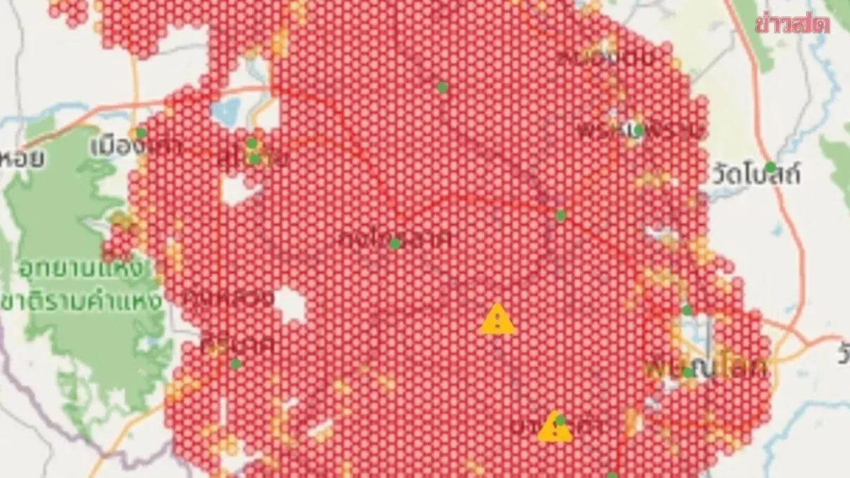
At 9:29 a.m. on 21 August, the Geo-Informatics and Space Technology Development Agency, or GISTDA, released data from its Check Water application, which analyzes satellite imagery and geospatial information. High-risk alert zones (marked red) form a large, continuous area covering the river basins of Sukhothai, Phichit and neighbouring provinces, totalling over 3,900 square kilometres of at-risk terrain.
Sukhothai province faces widespread impact, with dense high-risk areas clearly spread across the central and lower portions of the province. Affected districts include Sawankhalok, Si Samrong, Mueang Sukhothai, Kongkrai Lad, and parts of Si Satchanalai in the north.
Phichit province's central and western areas show extensive high-risk zones, with water masses flowing from Sukhothai and covering key areas in Phrom Phiram, Bang Rakam, Mueang Phichit, and parts of Wat Boranimit district.
Adjacent areas and bordering provinces display both high-risk (red) and lower-risk (yellow) zones spreading across provincial boundaries into parts of Uttaradit, Phichit and Kamphaeng Phet.
The analysis relies on GISTDA satellite imagery with high precision and real-time updates, enabling accurate assessment of water mass direction and expansion. This helps relevant agencies and the public plan and respond to the flooding threat effectively.