Thailand Launches One Map Initiative to Standardize Land Data
Thailand's new One Map initiative creates a standardized national land boundary database to replace conflicting data from multiple agencies, with Phase 2 advancing across 77 provinces to improve land management and resolve jurisdictional di
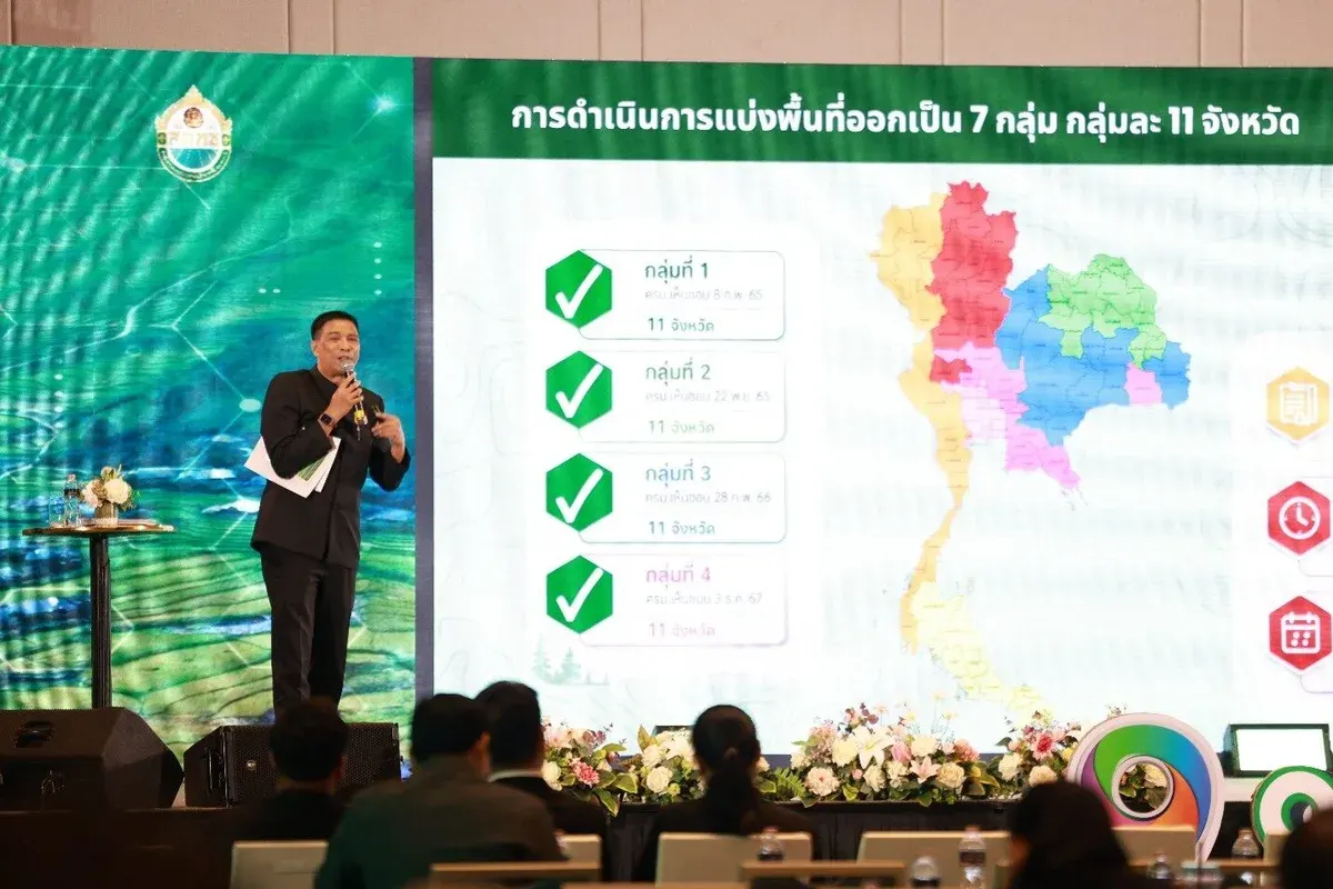
One Map represents more than a new map—it is the foundation for making state land transparent, accurate, and universally understood. Land issues touch nearly every aspect of life, from farming and housing to urban development, resource conservation, and national planning. Past government land management has been hampered by conflicting boundary data from different agencies, with some areas showing overlapping or inaccurate lines, causing misalignment across departments and confusion between officials and local residents. The One Map initiative—an integrated state land boundary mapping project at 1:4000 scale—aims to give the country accurate, clear, and uniform land boundary data under the principle of "one area, one responsible agency." In essence, One Map ensures all government agencies use the same map data, see identical boundaries, and understand which areas fall under whose jurisdiction, reducing duplication, resolving conflicts, and enabling systematic solutions to land problems at the local level. On July 16, 2025, the National Land Policy Committee Office (NLPCO) held a seminar on promoting understanding and advancing Phase 2 of the One Map project at the Asvapura Grand Convention Hotel. Deputy Prime Minister Thongsak Thongsri presided over the event, which brought together government officials, relevant stakeholders, and media to discuss the initiative's direction and explore practical applications of state land boundary data. The seminar featured presentations on the land boundary mapping operations and a panel discussion including Royal Thai Survey Department Director General Chakr Bunyapakdi, Institute of Political Science and Policy Analysis Director Assoc. Prof. Dr. Thanaporn Sriyakul, and Commissioner Poonsakdi Chanchapi on natural resources and environment to share lessons, challenges, and collaboration strategies going forward. Deputy PM Thongsak emphasized that the government prioritizes balanced natural resource use alongside agricultural land allocation, basic infrastructure development, livelihood promotion, and improved quality of life, with One Map serving as a crucial mechanism to clarify land boundaries fairly and enable effective area management. Currently, One Map covers seven provincial groups, with four groups totaling 44 provinces already approved by the cabinet, while groups 5, 6, and 7 covering 33 provinces have completed boundary mapping and await cabinet consideration. The heart of One Map lies not merely in a new map but in creating "central reference data" that all parties—government agencies, local officials, and citizens—trust and use together, enabling more effective state land management.