Article Archive
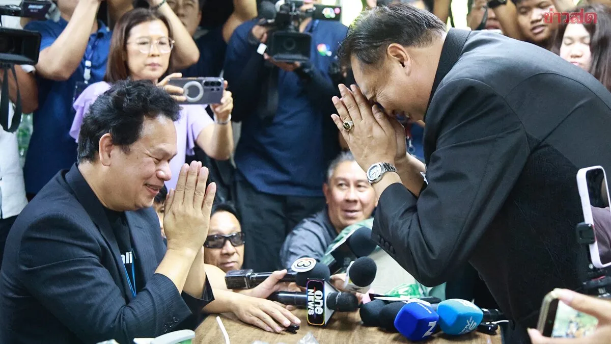
Suchart Apologizes to Reporters After Heated Exchange, Defends Officials Without Evidence
Natural Resources Minister Suchart Chamklin defended his agencies against corruption allegations from a survey, arguing claims need evidence before punishment and comparing oversight to protecting his children.

Hantavirus Survivor Opens Up: Infected at Age 5, It Was Like a Nightmare—Tormented and Traumatized
A California woman who contracted hantavirus at age 5 recounts her battle with the rare hemorrhagic virus, which caused severe bleeding and pain so intense she couldn't tolerate her hair touching her skin, leaving her with lasting psycholog

Health Ministry Reports Foreign Tourist Contracts Mpox After Contact with Strangers; Warns MSM Groups to Watch for Symptoms
Thailand's Health Ministry confirmed a foreign tourist contracted mpox after sexual contact with strangers in tourist areas, bringing the country's total cases to 1,074 with 16 deaths. Health officials are urging men who have sex with men t

Cabinet Approves Thailand Helps Thailand Plus and Fifty-Fifty Plus Programs with Conditions Revealed
Thailand's cabinet approved relief programs providing 1,000 baht monthly payments to over 43 million people from June through September 2025, with general public applicants required to register via mobile app between May 25-29.

BOI Highlights SUBCON Thailand's Success, Generating 23 Billion Baht in Trade Value
SUBCON Thailand 2026 generated over 23 billion baht in component trading value across 50,000 visitors and 9,600 business negotiations, connecting Thai manufacturers with international buyers in sectors including electric vehicles, electroni

Port Authority FC Unveils Nitipong's Return for Second Squad Assault in New Season
Right-back Nitipong Selanon returns to Port Authority FC for the 2026/27 season after leaving True Bangkok, aiming to win the domestic championship and compete in the AFC Champions League Elite.

Music News – Ton Thanasit Launches Solo Career with New Single 'Sak Tee (Once)'
R&B artist Ton Thanasit launches his solo career with new single 'Sak Tee (Once)', a romantic track about longing for love featuring collaboration with artist PAIRY.
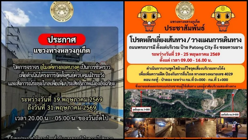
Highway works to affect Patong Hill, Bang Khu underpass
Motorists should expect delays on Phra Baramee Road between Kathu and Patong this week as highway resurfacing work and overnight Bang Khu Underpass closures for Smart City upgrades take place.
Prasit Blasts Pipat's "Shallow Thinking" on Banning Trains from City Center, Says it Shifts Burden to Public
Opposition coalition coordinator Prasit criticized Deputy PM Pipat's proposal to ban trains from Bangkok's city center following a collision, calling it "shallow thinking" that burdens commuters instead of addressing root causes like poor t
Cabinet Approves Energy Ministry Talks with Refineries to Help Lower Fuel Prices
The Cabinet has approved a proposal authorising the Ministry of Energy to negotiate with oil refineries to help reduce domestic fuel prices and ease the burden on the public. The decision was ma...
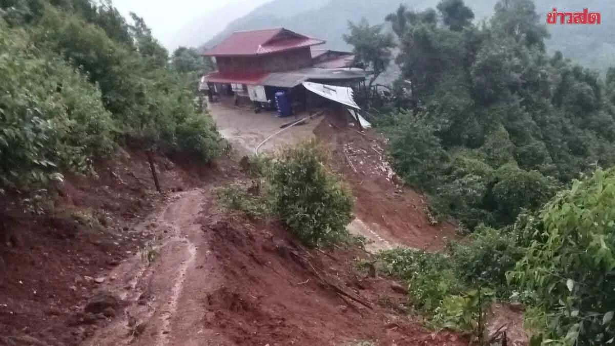
Geological Department Warns 9 Provinces of Heavy Rain, Flash Floods, and Landslide Risk in Hillside Areas
Heavy rainfall across nine provinces including Tak, Phitsanulok, and Nakhon Sawan poses significant risk of landslides and flash floods in hillside areas through May 20, the Geological Department warns.
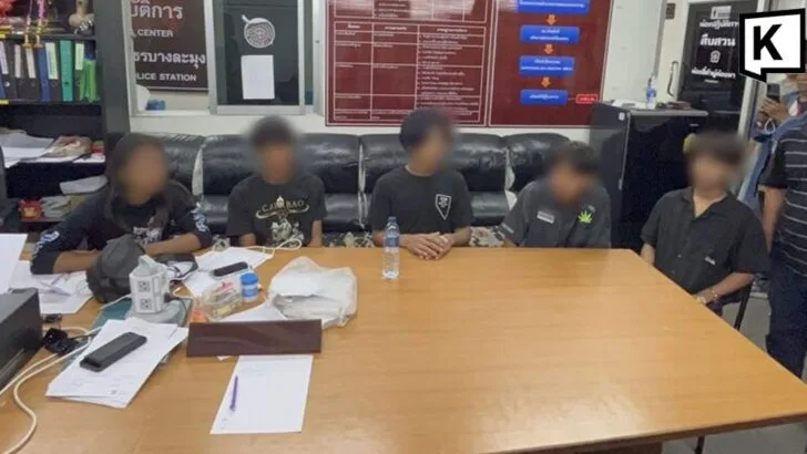
Myanmar Teens Held After Assault on Thai Youth in Pattaya
Myanmar teenagers detained in Pattaya after allegedly assaulting a Thai boy and stealing his shoes on Sukhumvit Road, though the suspects claim they were robbed at gunpoint first and acted in self-defense. Police are reviewing CCTV footage