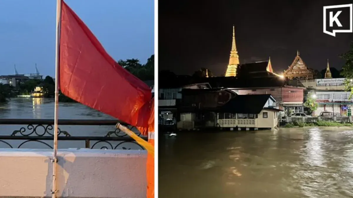
Khao Yai Flash Floods Swamp Four Districts in Prachin Buri
Flash floods from Khao Yai National Park have inundated four districts in Prachin Buri province, with Prachantakham experiencing its worst flooding in 30 to 40 years after rainfall exceeded 100 millimeters. Authorities closed six tourist si

Flash floods from Khao Yai National Park have inundated four districts in Prachin Buri province, with officials describing the situation in Prachantakham as the worst in 30 to 40 years. Authorities have ordered the temporary closure of six tourist sites, including several waterfalls, after accumulated rainfall in parts of Khao Yai exceeded 100 millimeters.
The flooding affected Kabin Buri, Si Maha Phot, Prachantakham and Na Di districts, while officials mobilized emergency teams to evacuate residents, particularly vulnerable groups, and establish temporary shelters.
At 23:40 on 26 September 2026, reports from Prachin Buri said heavy and continuous rainfall in Khao Yai National Park had sent muddy, reddish floodwater rushing into streams and waterfalls, causing water levels to rise rapidly.
Chaiya Huayhongthong, chief of Khao Yai National Park, said accumulated rainfall on the Prachin Buri side, particularly around Takro Waterfall in Prachantakham district and Kaeng Hin Phoeng in Na Di district, had exceeded 100 millimeters.
Authorities classified the situation as highly dangerous and ordered six tourist checkpoints and attractions to close for two days: Noen Hom checkpoint in Prachin Buri, San Chao Pho Khao Yai checkpoint in Nakhon Ratchasima, Takro Waterfall in Prachantakham, Kaeng Hin Phoeng in Na Di, Sarika Waterfall, and Krok E-Dok Waterfall in Saraburi.
Prachin Buri Governor Weeraphan Dee-on held an emergency meeting with Krit Kasampan, chairman of the Prachin Buri Provincial Administrative Organization, to establish an emergency command center to monitor the flood situation. The immediate priorities are protecting residents, evacuating vulnerable people, establishing shelters, and providing food and public health assistance.
Deputy provincial governor Chanathip Khokmani, together with local authorities, distributed relief packages and visited flood-affected residents at the 100-Year Old Market community in Kabin Buri Municipality. Officials also inspected temporary shelters at Wat Wang Dinso and Wat Wang Tha Chang.
Kabin Buri district chief Thammarat Ngamsaeng said flooding had spread across all 14 subdistricts. A large volume of water from Wang Tha Chang subdistrict flowed into Wang Takhian, Bo Thong and Yan Ri before reaching the 100-Year Old Market community, a lower-lying area that serves as a water catchment zone.
Water overflowed the riverbanks to depths of 1.56 to 1.70 meters, with some areas submerged above head height. More than 120 families were affected. Although water levels in Wang Tha Chang have begun to fall, around 130 to 140 families remain at temporary shelters at Wat Wang Dinso and Wat Wang Tha Chang because their homes remain covered in mud and are not yet suitable for habitation.
Highway 359 is now passable, although motorists are being warned about standing water near the Sukaphum Bridge. Si Maha Phot district has been flooded across all 10 subdistricts.