Heavy Rain Warning Issued for 40 Provinces
Thailand's Meteorological Department issued a weather alert for 40 provinces as heavy rainfall expected through September 28 may trigger flash floods and landslides, particularly in the north, central, and eastern regions.
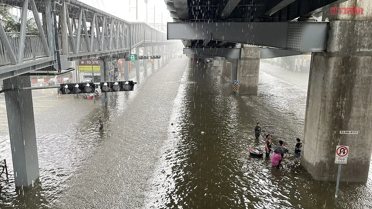
Thailand's Meteorological Department has issued a weather alert for 40 provinces as heavy rain is expected to affect 70 percent of affected areas. Bangkok and its vicinity face localized heavy rainfall that may trigger flash floods and forest runoff.
As of September 28, 2025, the Meteorological Department forecasts that the western north, central west, and eastern regions will continue to experience heavy to very heavy rainfall in some areas over the next 24 hours. Other regions will see reduced rainfall amounts but still face potential heavy downpours in some locations.
The public, especially in the north, central, and eastern regions, is urged to be alert to hazards from heavy to very heavy rain and accumulated rainfall, which may cause flash floods, cumulative flooding, overflowing riverbanks, and forest runoff, along with landslides. Areas near hillside slopes adjacent to waterways and low-lying zones should avoid traveling through roads with recurring flooding problems, particularly low-lying areas where sudden flash flooding is possible.
A low-pressure system has moved into the Gulf of Martaban, while the southwest monsoon remains moderately strong across the Andaman Sea, southern Thailand, and the Gulf of Thailand. Waves in the upper Andaman Sea and upper Gulf of Thailand are moderately strong, measuring 2 to 3 meters, with thunderstorm areas experiencing waves exceeding 3 meters.
Fishermen in the Andaman Sea and Gulf of Thailand are advised to navigate with caution and avoid areas with thunderstorms. Small boats in the upper Andaman Sea and upper Gulf should not venture offshore until September 28, 2025.
Weather forecast for Thailand from 6:00 a.m. today to 6:00 a.m. tomorrow:
North: Thunderstorms affecting 60 percent of the area with heavy rainfall in parts of Chiang Rai, Lampun, Lampang, Phrae, Sukhothai, and Phichit provinces, and very heavy rainfall in some areas of Mae Hong Son, Chiang Mai, and Tak. Lows 23–25°C, highs 30–34°C, easterly winds 10–20 kph.
Northeast: Thunderstorms affecting 60 percent of the area with heavy rainfall in parts of Chaiyaphum, Nakhon Ratchasima, and Buriram. Lows 23–24°C, highs 30–33°C, easterly winds 10–25 kph.
Central: Thunderstorms affecting 70 percent of the area with heavy rainfall in parts of Chai Nat, Lop Buri, Saraburi, Sing Buri, Ang Thong, Ayutthaya, Nakhon Pathom, Samut Sakhon, and Samut Songkhram provinces, and very heavy rainfall in some areas of Nakhon Sawan, Uthai Thani, Suphan Buri, Kanchanaburi, and Ratchaburi. Lows 22–24°C, highs 28–31°C, variable winds 10–25 kph.
East: Thunderstorms affecting 70 percent of the area with heavy rainfall in parts of Prachuap Khiri Khan, Sa Kaeo, and Chachoengsao, and very heavy rainfall in some areas of Nakhon Nayok, Chon Buri, Rayong, Chanthaburi, and Trat. Lows 23–24°C, highs 28–32°C, southwest winds 20–40 kph. Seas with waves 2–3 meters, exceeding 3 meters in thunderstorm zones.
South (East Coast): Thunderstorms affecting 60 percent of the area with heavy rainfall in parts of Phetchaburi and Prachuap Khiri Khan. Lows 21–24°C, highs 30–34°C. From Surat Thani northward: southwest winds 20–35 kph, seas with waves around 2 meters, exceeding 3 meters in thunderstorm areas. From Nakhon Si Thammarat southward: southwest winds 15–35 kph.