Satellite Images Show Green Algal Bloom in Thailand's Pasak Reservoir
Satellite images from GISTDA show the Pasak Jolasid Reservoir’s water turning green as floodwaters wash nutrients from surrounding farmland into the reservoir, sparking a rapid algal bloom. The images, taken in October 2069, reveal the reservoir is near full capacity and highlight the utility of satellite monitoring for water management and disaster response.
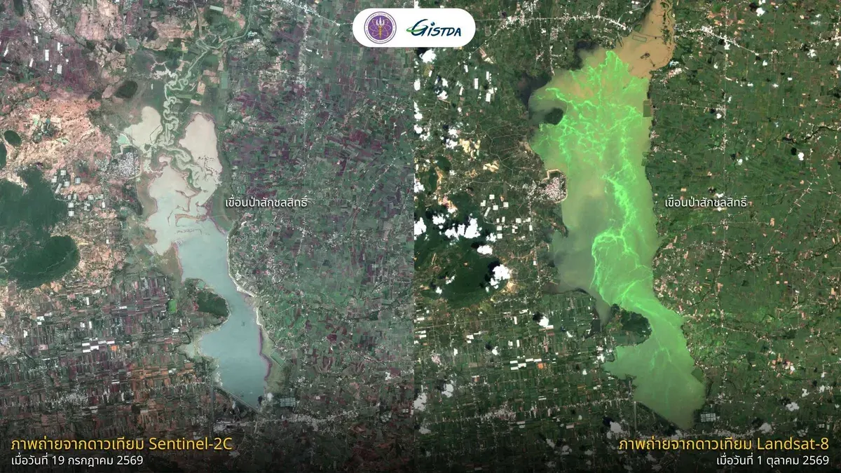
GISTDA released satellite images showing the water in Pasak Jolasid Reservoir turning green due to rapid algal and phytoplankton growth caused by floodwaters carrying nutrients from chemical and organic fertilizers from surrounding farmland. On October 7, 2069, the agency published imagery comparing Sentinel-2C data from July 19, 2069 with Landsat-8 data from October 1, 2069, highlighting clear changes in both water volume and quality. The images reveal a substantial increase in reservoir volume, nearing full capacity, and a green tint resulting from nutrient runoff during heavy rains, which triggered rapid algal and phytoplankton proliferation. GISTDA noted that satellite imagery is a valuable tool for monitoring large‑area changes, aiding disaster response, water management, and post‑event rehabilitation.