Satellite Images Reveal Severe Flooding Across Suphan Buri Farmland
Satellite images from GISTDA show severe flooding across Suphan Buri’s farmland, affecting over 23,000 rai in the Mueang district. The floodwaters have inundated Don Pho Thong and Don Kam Yan sub‑districts, damaging crops and infrastructure. Authorities are using the data to plan relief and recovery operations.
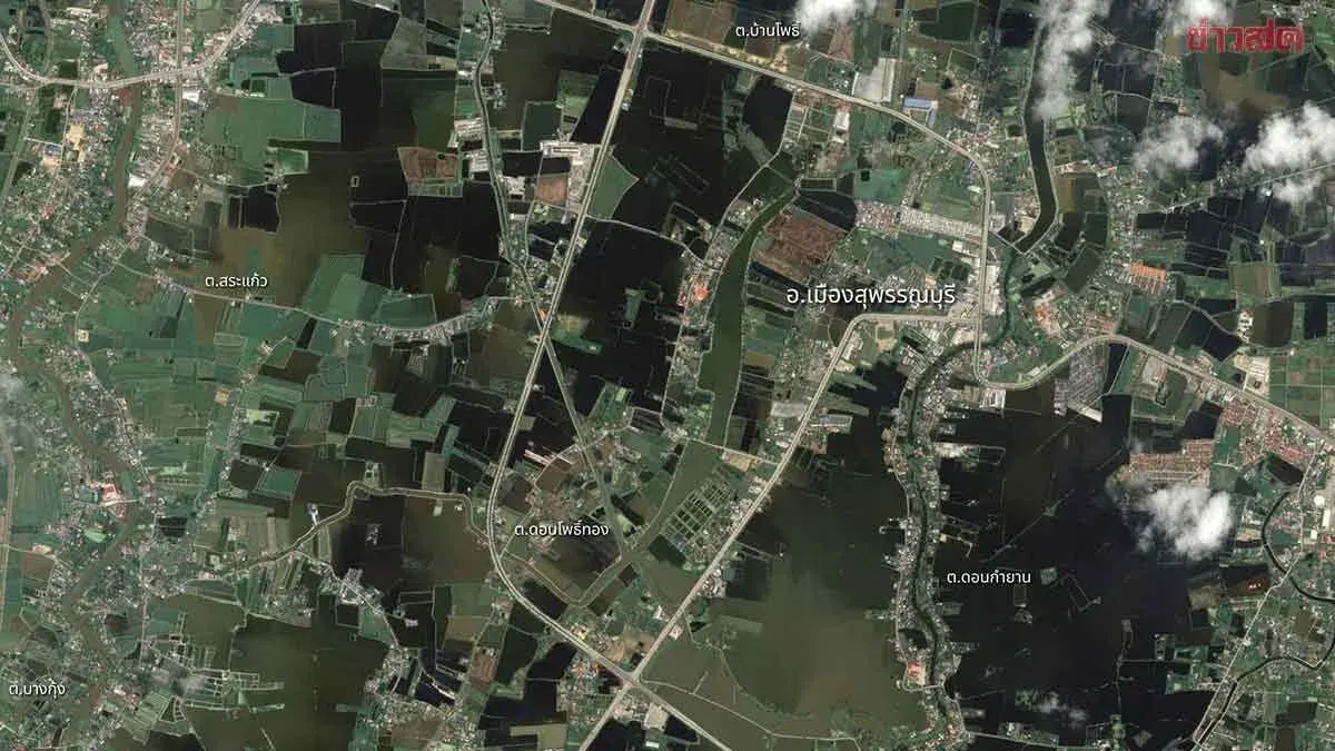
GISTDA released satellite imagery from THEOS-2 captured on October 5, 2026, showing extensive flooding in Suphan Buri’s Mueang district. The images reveal submerged farmland and low-lying areas covering more than 23,000 rai, particularly in Don Pho Thong and Don Kam Yan sub-districts. The visuals clearly outline agricultural plots, roads, and community structures, with darker shades indicating stagnant water. GISTDA has supplied the data to concerned authorities to support relief operations, water drainage planning, and post‑flood recovery efforts, highlighting the importance of satellite technology in flood assessment and disaster management.