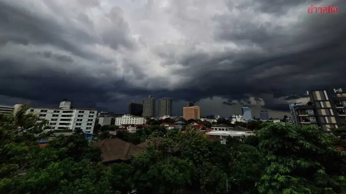
Thailand's Meteorological Department warns of heavy rain across the north and upper northeast through tomorrow as the southwest monsoon intensifies, with a low-pressure system over northern Vietnam driving the weather pattern.
On July 21, 2569, the Thai Meteorological Department issued a 24-hour weather forecast predicting increased rainfall across Thailand, with heavy rain in some areas of the north and upper northeast. The intensifying southwest monsoon affecting the Andaman Sea, Thailand, and the Gulf of Thailand, combined with a low-pressure system over northern Vietnam, is driving the forecast. Residents in the north and upper northeast are advised to be vigilant against hazards from heavy and accumulated rainfall.
The upper Andaman Sea and upper Gulf of Thailand will see waves of 1–2 meters, while the lower Andaman Sea expects waves around 1 meter. Areas with thunderstorms may see waves exceeding 2 meters. Fishermen are cautioned to exercise care and avoid sailing in thunderstorm zones.
A low-pressure system strengthening over the Pacific Ocean is expected to intensify into a depression and move across the northern Philippines between July 24–25, 2569.
Detailed forecasts for 6 p.m. today through 6 p.m. tomorrow:
North: Thunderstorms affecting 60% of the area with heavy rain in some zones, mainly in Mae Hong Son, Chiang Mai, Chiang Rai, Phayao, Nan, Lamphun, Lampang, and Tak provinces. Low 21–26°C, high 28–35°C. Southwest winds 10–20 km/h.
Northeast: Thunderstorms affecting 40% of the area with heavy rain in some zones, mainly Nong Khai, Bueng Kan, Sakon Nakhon, and Nakhon Phanom. Low 23–25°C, high 32–36°C. Southwest winds 10–20 km/h.
Central: Thunderstorms affecting 40% of the area, mainly Nakhon Sawan, Uthai Thani, Chai Nat, Lopburi, Saraburi, Kanchanaburi, and Ratchaburi. Low 25–26°C, high 35–37°C. Southwest winds 10–20 km/h.
East: Thunderstorms affecting 40% of the area, mainly Chachoengsao, Nakhon Nayok, Prachuap Khiri Khan, Rayong, Chanthaburi, and Trat. Low 23–27°C, high 33–36°C. Southwest winds 15–35 km/h. Seas 1–2 meters; over 2 meters in thunderstorm areas.
South (East Coast): Thunderstorms affecting 30% of the area, mainly Phatthalung, Songkhla, Pattani, Yala, and Narathiwat. Low 22–25°C, high 32–36°C. Southwest winds 15–30 km/h. Seas around 1 meter; over 2 meters in thunderstorm zones.
South (West Coast): Thunderstorms affecting 40% of the area, mainly Phuket, Krabi, Trang, and Satun. Low 23–25°C, high 32–35°C. From Phang Nga northward: southwest winds 15–35 km/h, seas 1–2 meters, over 2 meters in thunderstorms. From Phuket southward: southwest winds 15–30 km/h, seas around 1 meter, over 2 meters in thunderstorm areas.
Bangkok and surrounding areas: Thunderstorms affecting 40% of the area, mainly afternoon to evening. Low 26–28°C, high 35–37°C. Southwest winds 10–20 km/h.