What the Koh Lanta bridge has to cross: mangroves, macaques and a non-hunting area
The planned Koh Lanta Bridge will span 1.4 kilometres across mangroves and a marine wildlife area, with construction taking three years and the structure designed to withstand four-metre tsunami waves like the 2004 Indian Ocean disaster.
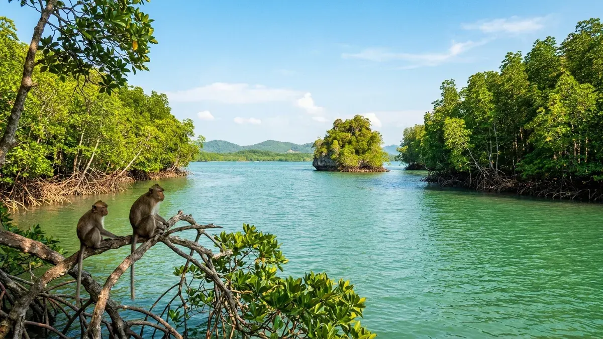
Photo: Illustration generated by Lanta News
The bridge that will finally end the car ferry to Koh Lanta has to cross more than water. Before it can be built, somebody had to count what is living in the way.
That count now exists in public. A Critical Habitat Assessment for the Koh Lanta Bridge, dated 13 May 2025, was written for Thailand's Department of Rural Roads at the Ministry of Transport and disclosed through the World Bank, which is helping finance the crossing. It is a draft consultant report submitted for review, not a final approval, and it should be read that way. But it is the most detailed public description of what the bridge will actually touch, and almost none of it has been reported in English.
What is being built
The bridge is part of a larger scheme called the Thailand Resilient Transport Connectivity and Irrawaddy Dolphin Conservation Project, run by the Department of Rural Roads together with the Department of Marine and Coastal Resources at the Ministry of Natural Resources and Environment.
It crosses the Khlong Chong Laad channel and connects the subdistricts of Koh Klang on the mainland side and Koh Lanta Noi. The report gives the project route as 2.527 kilometres, with a bridge span of 1,405 metres. Two lanes, one each way, and three bends so the structure can pass around the small island of Koh Pling sitting in the channel.
Some of the engineering detail is striking. The deck height is set against an average high tide of +1.08 metres and is designed to accommodate a tsunami wave of roughly four metres — the report names the 2004 wave that struck this coast as the reference. It will stand on 40 piers, each a single column 2.5 metres deep and 6.2 metres wide, in concrete mixed to resist the chloride and sulphate in seawater, with permanent steel casings against corrosion. Construction is put at three years with a workforce of 170.
A figure that does not match
One number is worth flagging rather than smoothing over. This 2025 draft puts the bridge span at 1,405 metres inside a 2.527 km route. When Deputy Prime Minister and Transport Minister Phiphat Ratchakitprakarn set out the schedule in Krabi on 23 August 2026, the figures given were about 1,780 metres of bridge plus roughly 747 metres of approach road — which comes to the same 2,527 metres in total, but splits it differently.
The totals agree exactly. The span does not. Designs are revised between a draft assessment and a ministerial announcement fifteen months later, and that is the most likely explanation, but we have not been able to confirm which figure is current. Our guide to driving here carries the minister's version and the 2029 completion date.
Three protected areas in the way
The route passes through the Thung Thale Non-hunting Area, which covers 25.72 square kilometres and is declared under the Wildlife Conservation and Protection Act. The assessment notes something most visitors will never have heard: this reserve protects Thailand's only large expanse of Melaleuca forest, and it connects to the mangroves alongside it.
The road also runs adjacent to the Middle Island National Forest and passes through the Pa Lang Sot and Kuan Ba Kan Koh national forests for 569 metres, affecting 4 rai (0.64 hectares). Those reserves hold mangrove forest designated by Cabinet resolutions of 22 August and 14 October 2000. Permission to build through them has been granted by the Royal Forestry Department.
Wider still, the non-hunting area sits inside the Krabi Environmental Protected Area of B.E. 2016, which runs 1,925 square kilometres along this coast. Mu Ko Lanta National Park is not directly affected. Two Ramsar wetlands — the Krabi Estuary, and the Had Chao Mai / Ta Libong / Trang River Estuaries site — are in the wider vicinity and are not expected to be harmed.
The mangroves: 1.2 rai, and a twenty-fold replant
The headline mangrove number is smaller than you might expect. The route cuts through 129 metres of mangrove on the Koh Lanta side, covering 1.2 rai — 0.192 of a hectare, about a fifth of a football pitch.
What happens next is set by regulation rather than goodwill. The Department of Marine and Coastal Resources rule on mangrove restoration (B.E. 2556) requires that any government agency using mangrove forest must fund replanting of "not less than 20 times of the area that was utilized". Money for that is allocated in the project's environmental management budget, and the DMCR picks the degraded site and the species. On paper that turns 1.2 rai of loss into roughly 24 rai of new planting.
Here the draft contradicts itself, and we are not going to paper over it. It states that "40 trees will need to be cut, of which 47 are mangrove tree species". Forty-seven cannot be a subset of forty. One of those two numbers is wrong, and the document as published does not say which.
The monkeys are the main wildlife problem
The assessment screened the area for species that would legally force the project to deliver a net conservation gain. Irrawaddy dolphin, dugong and four sea turtle species — green, hawksbill, leatherback and olive ridley — all occur in the wider area and all qualify as the kind of feature that can trigger that duty. The report's conclusion is that significant impacts on them are not predicted, so no compensation measures are required for them, though monitoring and mitigation stay in the plan.
The one land animal on the list is the long-tailed macaque. It is protected under the Wild Animal Conservation and Protection Act B.E. 2562 and, in the report's own words, abundant here. The head of the Thung Thale Non-hunting Area, Mr Suwat Suksiri, estimated in July 2019 that there were 250 to 300 macaques on the Koh Klang side and 200 to 300 on the Koh Lanta Noi side.
The concern is not that the bridge will displace them. It is that a construction camp full of food, and later a stream of visitors, gives several hundred territorial, practised thieves a new opportunity. The report is blunt that the monkeys already steal from people and injure tourists, and records that the non-hunting area has asked Krabi Province for a budget to control the population by sterilisation. The troops are territorial, so the report judges it unlikely that individuals will start crossing between the two sides because of the bridge.
The corals, and an argument that the bridge helps
There are corals around Koh Pling, and the report describes them as already degraded, largely by boat activity. The route bypasses them, and construction impacts are described as temporary.
Then it makes a claim worth watching: once the bridge is open there will be considerably less boat activity in the channel, and some of the pressure on those corals should come off. Whether that holds is something that can be measured after 2029, and we intend to.
What we could not verify
- Which bridge span is current — 1,405 metres in the 2025 draft, or the 1,780 metres given by the minister in 2026. The route total is the same in both.
- The tree count — the draft's own "40 trees ... of which 47 are mangrove tree species" does not reconcile.
- The project cost. We could not retrieve the World Bank project record for the financing figures, so we are not quoting any.
- Whether the draft was later changed. This is a consultant report submitted for review and finalisation in May 2025; we have not found a published final version.
The document itself is public: Koh Lanta Bridge, Thailand — Environmental Impact Assessment, Critical Habitat Assessment, draft consultant report to the Department of Rural Roads, 13 May 2025.
If you work on this project, or at the non-hunting area, and any of the above is out of date, we would rather be corrected than repeat it. Write to us at molly@lanta.news.